🚀 雷射掃描+點雲 = 工程界的透視眼!完整應用與效益解析
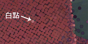
你有沒有發現,傳統工程量測不是資料缺漏,就是圖紙過時?這時候 雷射掃描 (Laser Scanning) 登場啦!它能在幾分鐘內,生成上億筆 點雲數據 (Point Cloud Data),把現場完整搬進電腦裡。
Ever noticed how traditional engineering measurements are often incomplete or outdated? That’s where Laser Scanning comes in! In just minutes, it generates millions of point cloud data, bringing the entire site into your computer.
🔍 技術說明 | Technology Explained
雷射掃描就像一台「空間相機」,透過雷射光束快速掃描建築、工廠或船舶,捕捉其三維幾何形狀。
Laser scanning works like a spatial camera, using laser beams to rapidly scan buildings, factories, or ships, capturing their three-dimensional geometry.
產生的結果就是點雲:由數以億計的空間坐標點組成,精確呈現物體的表面細節,精度可小於 3mm。
The result: Point Cloud Data, composed of millions of spatial coordinate points, accurately representing the object’s surface details, with an accuracy of <3mm.
這些點雲數據後續可無縫輸入 CAD / BIM 軟體,進行精確的建模、分析與設計,為後續工程提供堅實的數位基礎。
This point cloud data can then be seamlessly imported into CAD/BIM software for precise modeling, analysis, and design, providing a solid digital foundation for subsequent engineering work.
🏭 實務案例 | Real-World Cases
點雲數據的應用廣泛且效益顯著,以下為幾個典型的實務案例:
The applications of point cloud data are extensive and highly beneficial. Here are a few typical real-world cases:
工廠改善設計 | Factory upgrades:
快速建立現有工廠設施的精確數位模型,讓工程師能在虛擬環境中規劃新的設備佈局或管線路徑,有效避免施工時發現干涉,大幅縮短設計與施工週期。
Quickly build accurate digital models of existing factory facilities, allowing engineers to plan new equipment layouts or piping routes in a virtual environment, effectively preventing clashes during construction, and significantly shortening design and construction cycles.船舶改裝 | Ship retrofitting:
精確捕捉船舶內部和外部的現況細節,包括複雜的管路系統和設備配置。這些數據能強力支援管路、設備升級或空間重新規劃,確保改裝設計的精準性。
Accurately capture the current details of a ship’s interior and exterior, including complex piping systems and equipment configurations. This data strongly supports piping, equipment upgrades, or space re-planning, ensuring the precision of retrofit designs.建築翻新 | Building renovation:
即使原始建築圖紙遺失或不完整,雷射掃描也能快速重建完整的3D模型。這為建築結構評估、內部空間重新規劃或歷史建築保護提供了可靠的數位依據。
Even if original building drawings are lost or incomplete, laser scanning can quickly rebuild a complete 3D model. This provides a reliable digital basis for structural assessment, interior space redesign, or historical building preservation.
📊 效益整理表 | Benefits Table
| 🔹 功能 Function | ⚡ 雷射掃描+點雲效益 Benefits |
|---|---|
| ⏱️ 速度 Speed | 數分鐘收集數億點資料,效率提升 10 倍以上 Collect millions of points in minutes, 10x faster |
| 🎯 精度 Accuracy | 平均誤差 < 3mm Accuracy < 3mm |
| 📦 資料完整性 Data Integrity | 捕捉全場域,不遺漏任何細節 Capture the entire site with no missing details |
| 🔗 整合性 Integration | 可導入 Revit、Navisworks、AutoCAD Seamlessly integrates with major software |
| 💰 成本效益 Cost Efficiency | 減少 20–30% 返工與材料浪費 Save 20–30% on rework and material waste |
Q1:雷射掃描精度有多高?
📏 平均誤差小於 3mm。Q2:會不會因為數據太大不好用?
💾 不會,點雲可直接匯入 Revit、AutoCAD、Navisworks。Q3:適合哪些專案?
🏗️ 工廠改造、船舶改裝、建築翻新、基礎建設檢測。Q4:成本會不會很高?
💰 初期投資稍高,但平均可降低 20–30% 的返工成本。Q5:能與 BIM / Digital Twin 結合嗎?
🔗 當然!點雲 ➝ BIM ➝ Digital Twin,形成長期資產。雷射掃描+點雲,就是工程領域的「透視眼」!無論是工廠、船舶還是建築,都能快速、精確、完整地掌握現況,搭配 BIM 與數位雙生,形成長期的數位資產。
Laser scanning + point cloud is the X-ray vision of engineering! Whether for factories, ships, or buildings, it enables fast, accurate, and complete capture of conditions—seamlessly connecting to BIM and Digital Twins for long-term digital assets.
👉 銓崴3D雷射掃描 | 點雲應用 | BIM整合 | 數位轉型專家想把你的專案升級到數位雙生層級?馬上聯繫我們,打造專屬的 工程數位資產!

